Logbook 5: Lobornhutte (kind of)
Distance: 11.2km | Elevation Gain/Loss: 706m | Hiking Time: 5:07
Let me begin by caveating that 1. the Lobornhutte is not an official SAC hut (rather it is an unaffiliated, private mountain hut of which there are 225 of in Switzerland outside of the official 153 SAC ones) and 2. I didn’t get close enough to the hut to really say I visited it. Regardless, this was a big overnight trip and was a unique route so I wanted to share it regardless in the spirit of providing beta to the internet (and to fill up the initial content on this site :) )
This route began at the top station of the Luftseilbahn gondola in the Lauterbrunnen valley.
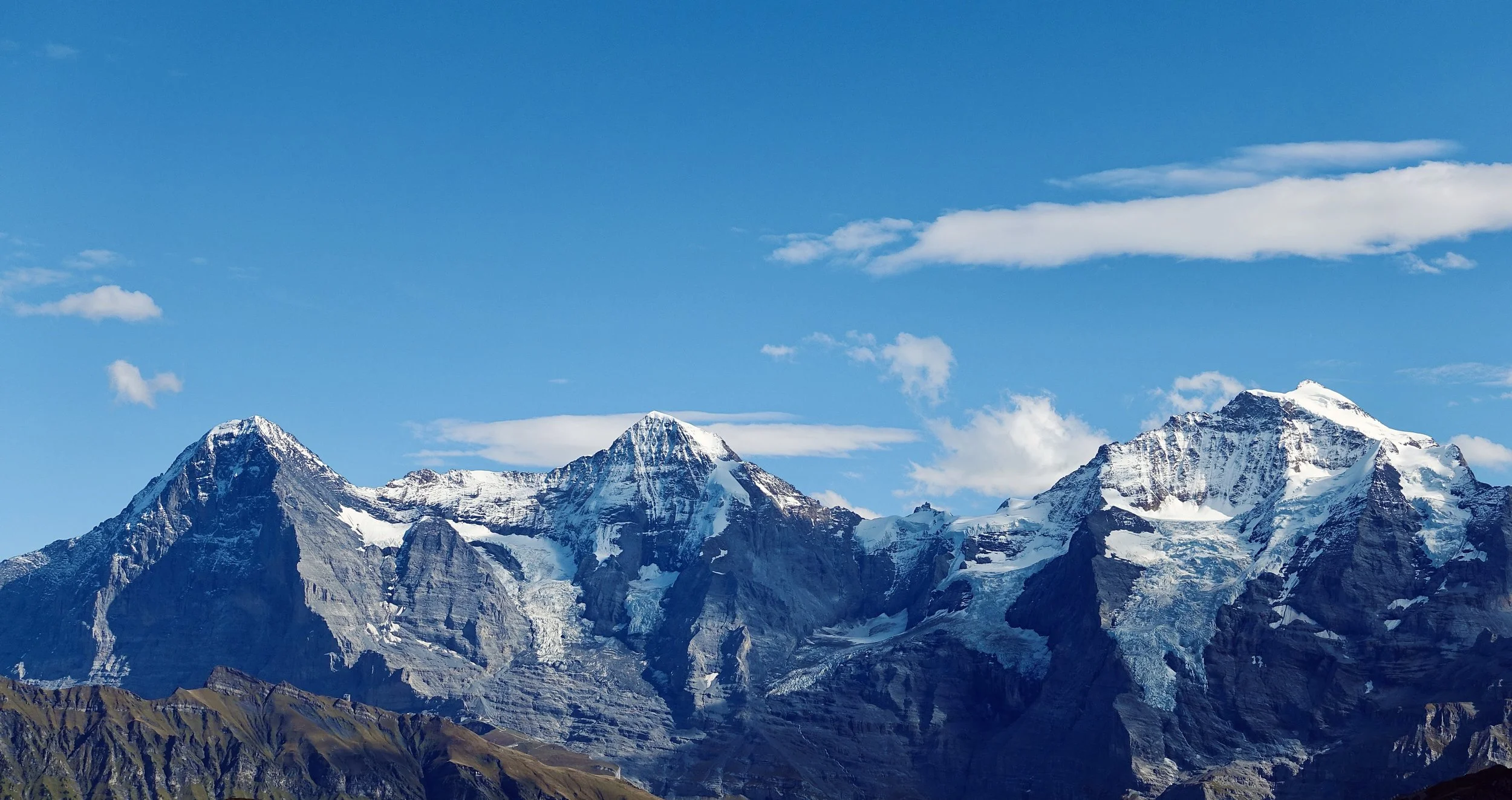
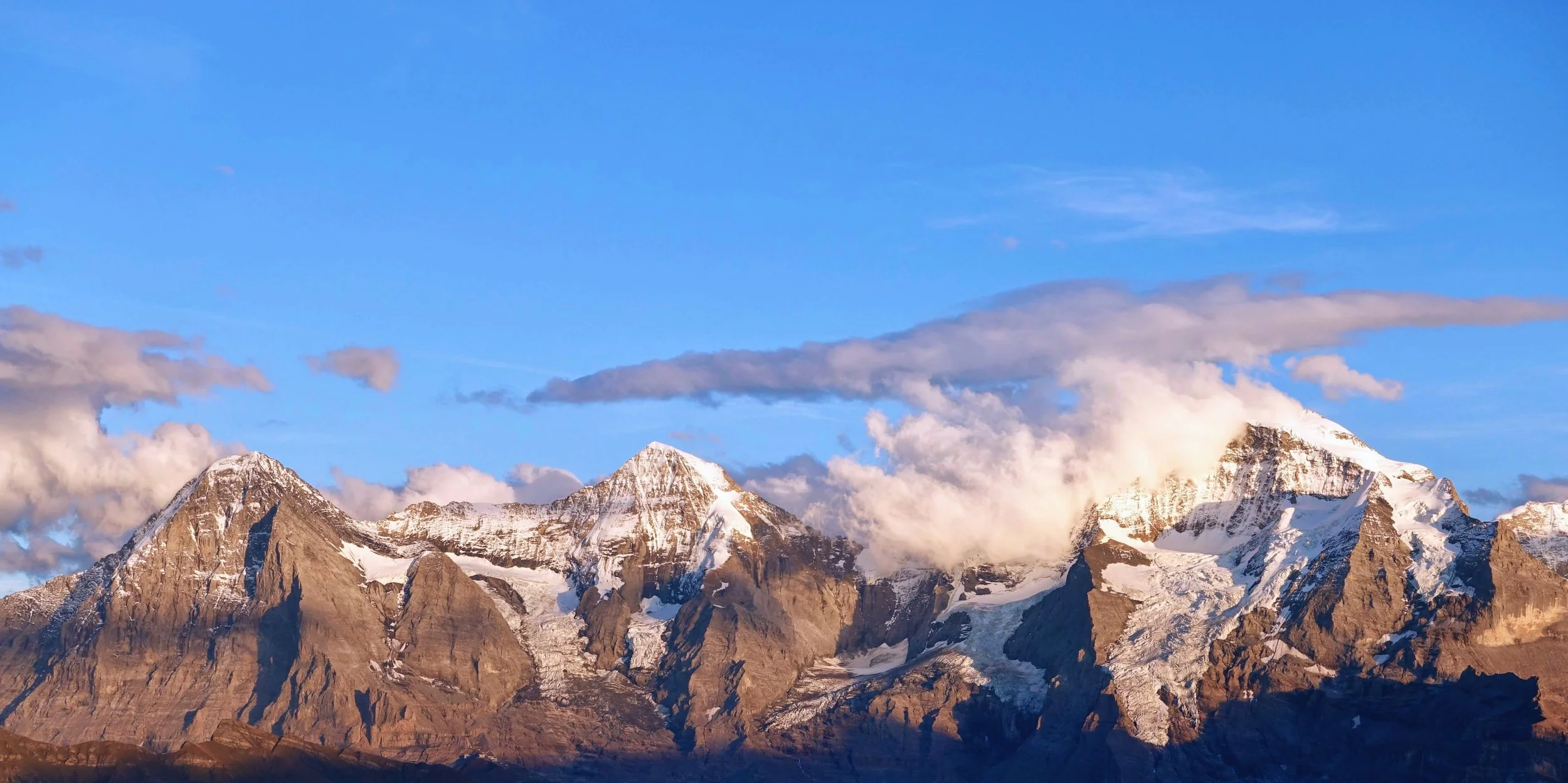
Almost immediately, the big three famous Swiss mountains - Eiger (troll), Monch (monk), and Jungfrau (young maiden) - come into view and occupy most of the horizon.
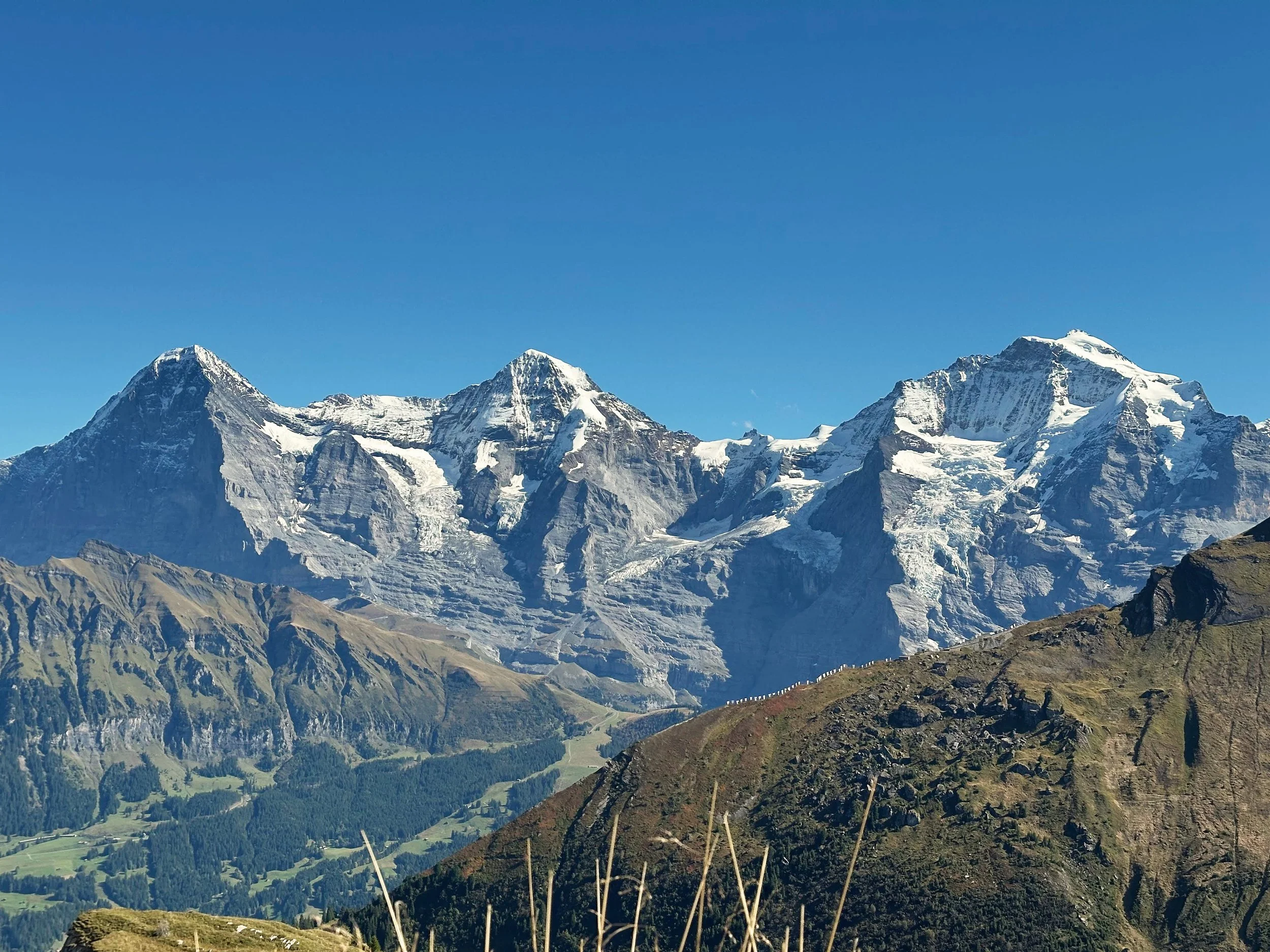
The Sphinx mountain station is visible at the bottom o the right saddle.
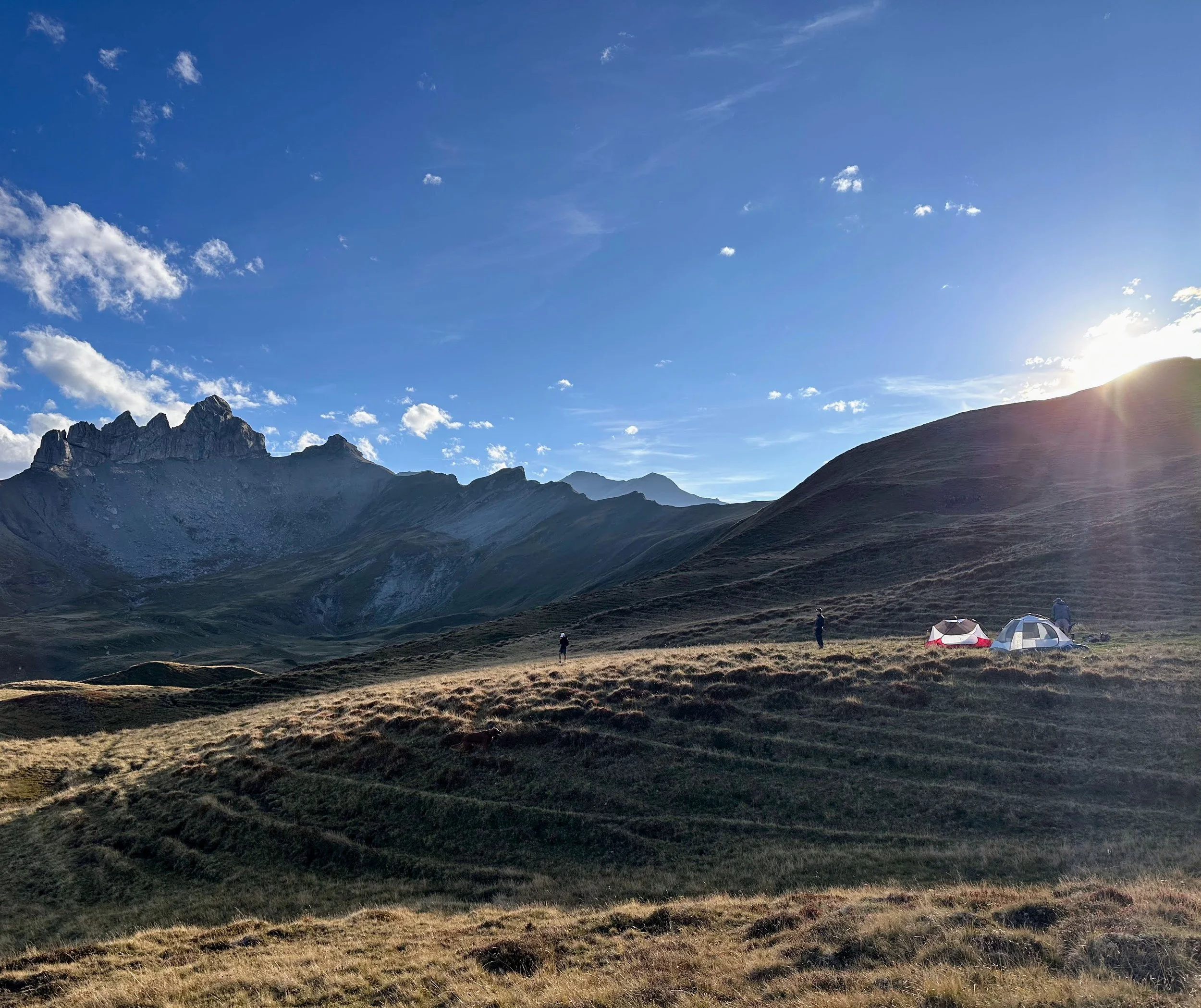
We broke trail right before the Schwarze Schopf summit (pt 2285) and headed northwest towards Overs Sulsseeli where we spotted some fairly flat grassland to camp for the night. Fair warning for anyone doing this route, the water in Obers Sulsseeli becomes stagnant and gross in late summer / autumn so fill your water containers in the streams before then. This alpine area showed heavy cattle use so I imagine the stagnant water has a lot of bacteria and things you don’t want in your stomach.
For those unaware, cows are much heavier than people and have hard hooves that are small to their relative weight. When you get hundreds of them roaming around a grassy alpine area, they make the ground a pitted mess that becomes one of the best places to sprain an ankle. Even with proper hiking boots, every few steps I felt my ankles and calves engaging so I wouldn’t completely tear every muscle and ligament in my ankle.
The friendly (hopefully) trail traffic
The views of the Big Three from our camp were hard to beat.
As the sun dropped below Nideri Sulegg ridge to the west, we scrambled up to the ridge trail connecting Hoji Sulegg and Chlys Lobhore. I hadn’t spent much time on true ridgeline trails such as the famous Hardergrat ridge near Lake Brienz just to the north of where we were camped.
When you are standing on a knife edge ridge like this, it is very easy for vertigo to set in. You only have 1-2 meters of flat(ish) area to walk and the nearly perfect straight line going in either direction of the trail messes up your vision, and therefore balance.
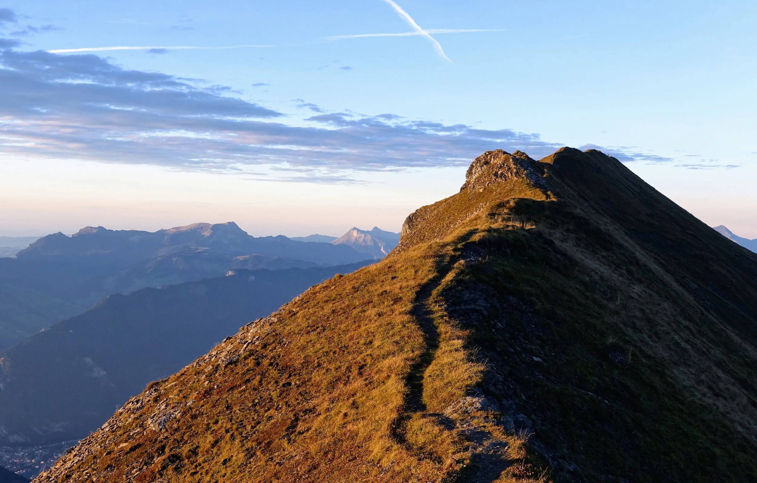
But the extraordinary views in every direction quickly made me forget the sketchiness of the ridge. The Big Three to our southeast were basking in the oranges and pinks of the setting sun.
And to the west the dying sun made its way down to the horizon with countless layers of mountain peaks