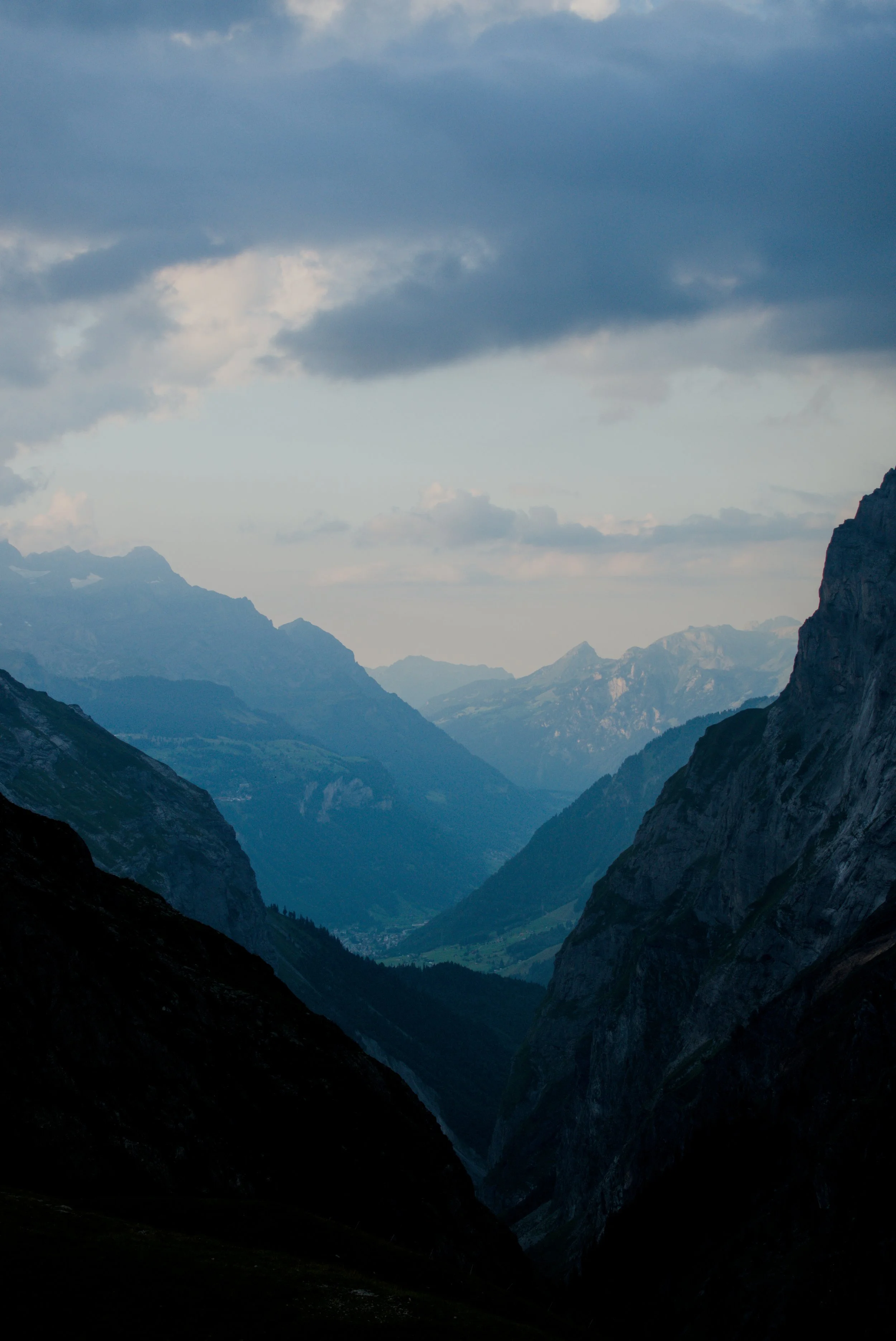
Logbook 14: The Grand Glarus Tour
Distance: 39.5km | Elevation Gain/Loss: 3,085m | Total Time: 12:19
Day 1
I believe that at least once a year, you should partake in some form of self-inflicted physical torture, I mean test. The Glarus Grand Tour (a name I completely made up) was this year’s edition of that test. Originally planned as a 4 hut loop, I ended up only being able to tackle 3 of the huts as I simply did not have the energy, or time, to get to the last one. But, I feel this is one of the best multi-hut routes one can do in Switzerland. It has all the things you want in a good route: varying scenery from forests to alpine meadows to high alpine environments, it has rivers, lakes, and waterfalls, it has wonderful flora and fauna wildlife, and it is far from being overrun by day trippers and tourists - outside of the huts themselves, I saw less than 10 people on the trails during my 3 days of hiking.
The tour starts and ends as a loop at Tierfed in southern Glarus just beyond the village of Linthal. It is a VERY popular place because of the gondola to the alpine lake of Limmerensee, a spot that has unfortunately become viral on Instagram and among influencers. When I arrived mid-morning on Saturday, the car park was overflowing, and I parked on the road hoping my car wouldn’t get towed or ticketed upon my return 3 days later - thankfully, my windshield note and the kind Glarnerland people didn’t care about my car being there.
This part of Glarus is special to me as it is where my great-great-grandparents, Jacob and Verena Freitag, emigrated from in the 1800s. The Elm and Linthal valleys were home to their families since the 1400s and maybe even earlier, though that is as far back as the records that I could find go.
The mission was to tackle the Fridonlinshutte, Gruehorenhutte, Planurahutte, and Claridenhutte. Sadly, the last one will need to be visited at a later date as my body didn’t have the energy to get to it on the last day.
The first few kilometers of the hike are along the forested road heading up the narrow valley between the Gamsistock and Hauserhorn peaks. Their steep walls tower 1,500m above you and provide much-welcomed shade throughout most of the day.
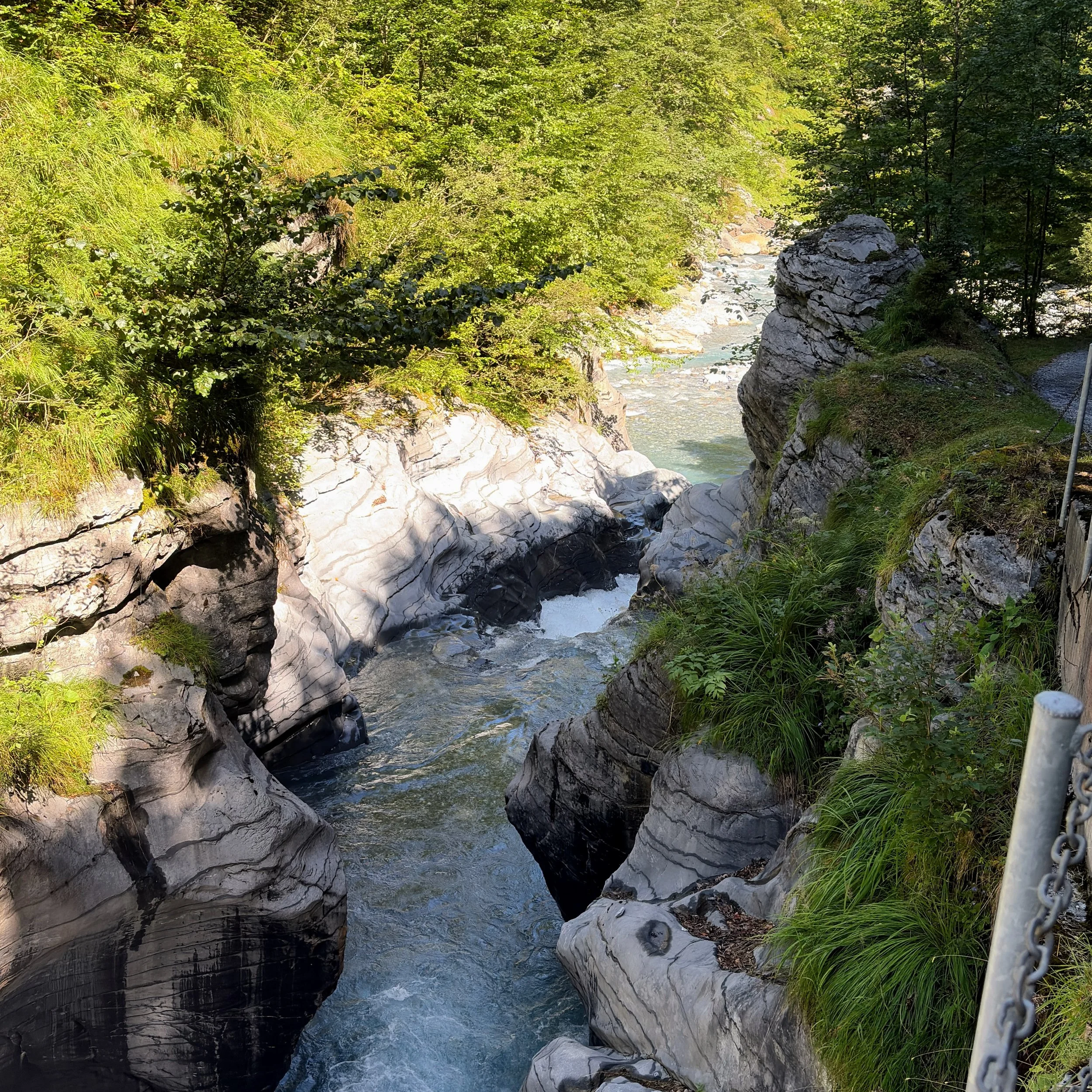
The headwaters of the Linth River, which you are following up the valley, have carved many slot canyons. The rock has curves in it that remind me of the Antelope slot canyons in southern Utah - the difference being that the Utah canyons are soft sandstone and these Linth rocks are 150 million year old malm limestone that has been polished by the millions of years of water erosion.
As the tree line thins out around 1,200m asl, the path ahead presents itself with walls jutting up to the south and the massive Todi massif coming into view with its eastern glacier field pouring out of its summit block.
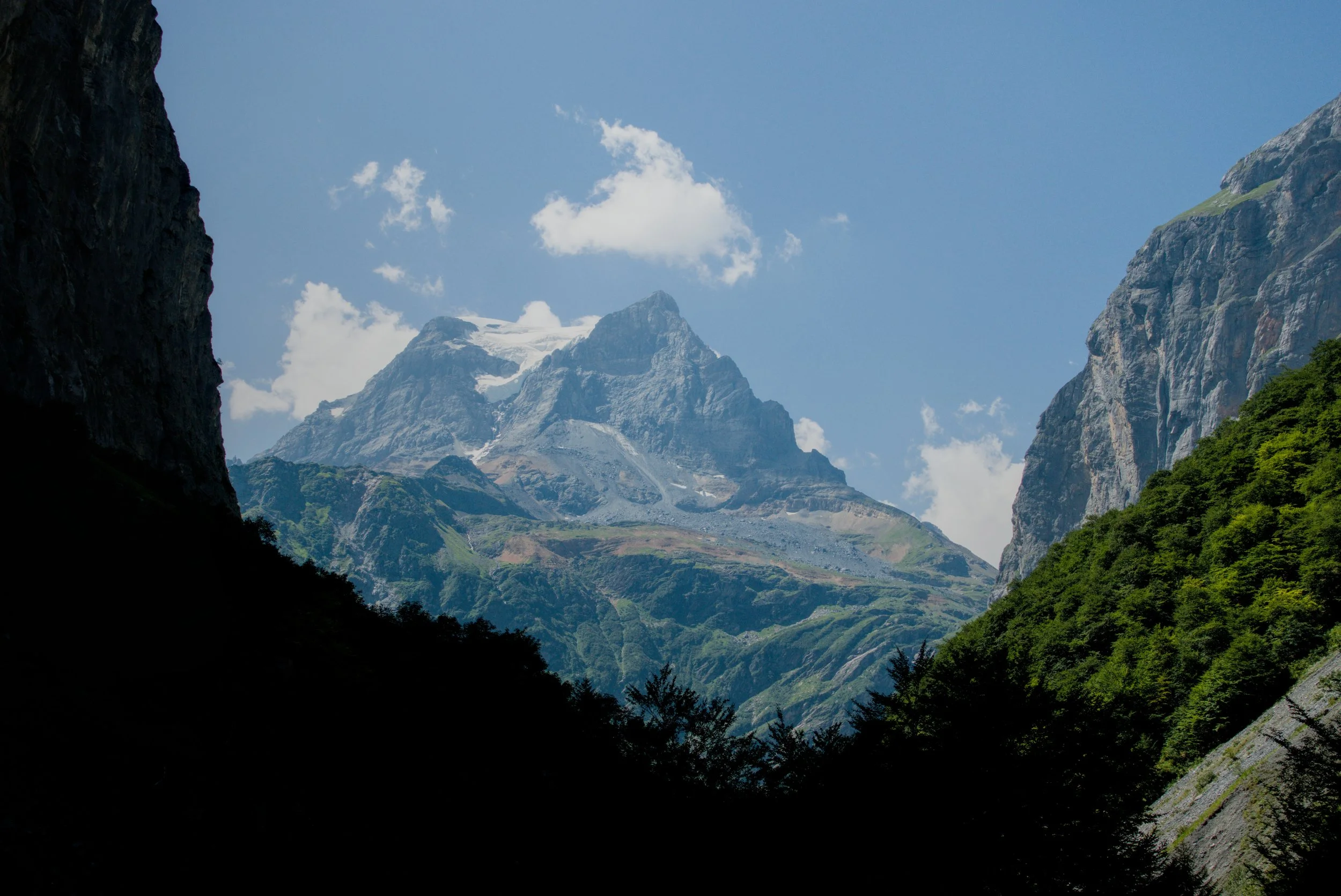
The Todi remains in view for the entirety of the tour and is always looking down on you like the Eye of Sauron.
The route flattens out for only a brief moment along the Hinter Sand valley floor, where there is a man-made reservoir and grazing land for the alpine cows.
The torture begins as you begin the 800m climb up the southern valley towards Fridolinshutte. The summer sun was reaching its apex in the sky as I started the climb. The forested spots were few and far between and completely disappeared around 1,500m asl so the full force of the sun and 30C heat was felt.
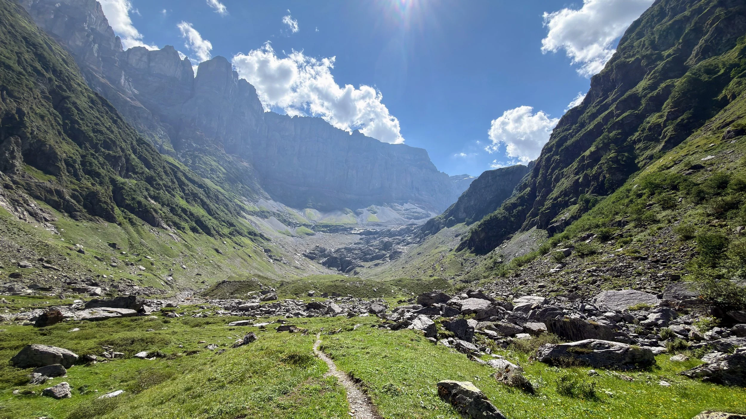
One barometer of how much I’m suffering is the frequency of photos in my camera roll. This 800m ascent took ~2 hours according to my Garmin watch and I only have a total of 5 photos from the climb. While I’m sure the views were impressive, I just zoned out and put one foot in front of the other to get to the top.
As I came over the last crest, the Fridolinshütte appeared like an oasis in a desert. I fell into one of the inviting lounge chairs and ate an apricot cake in about 3 bites.
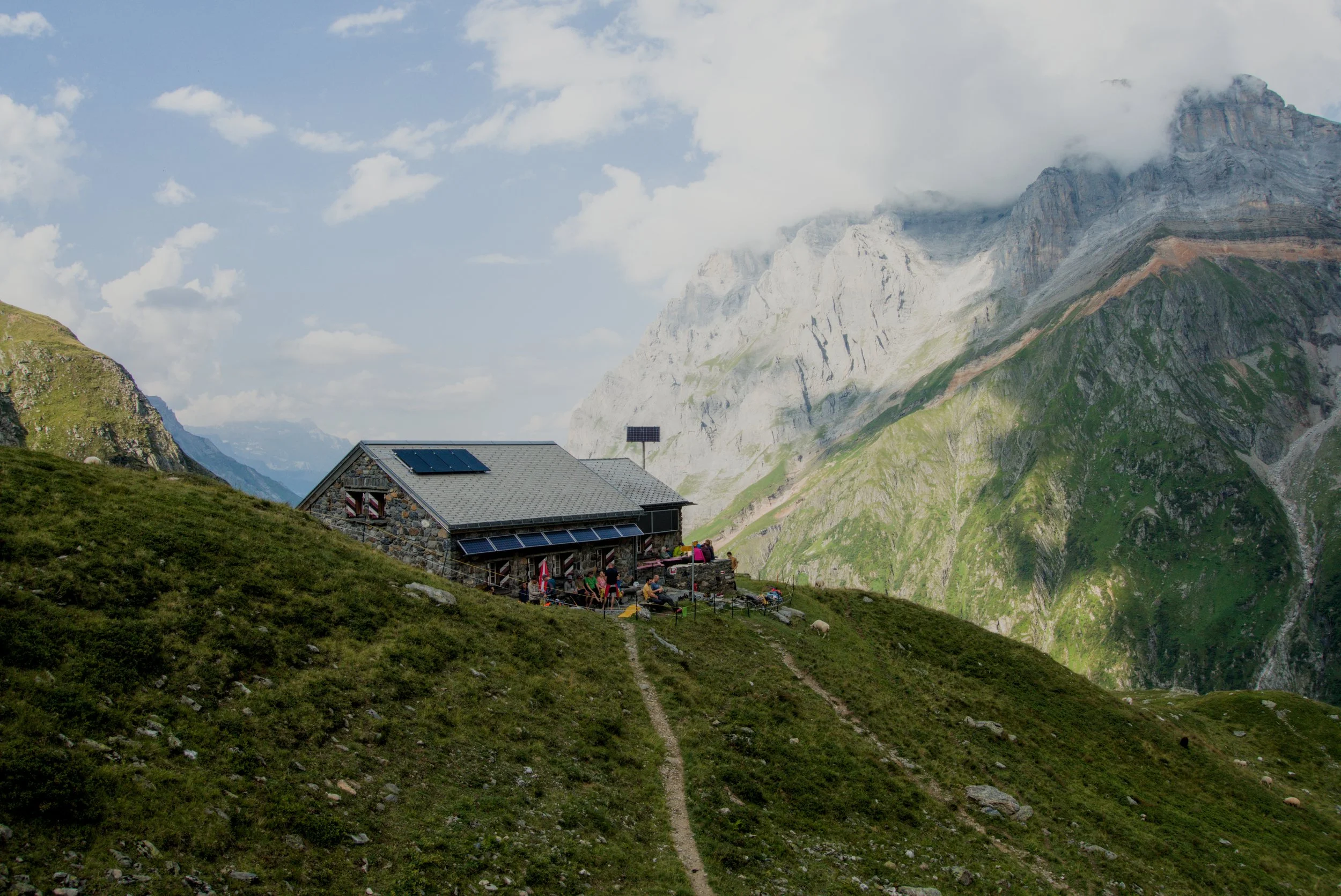
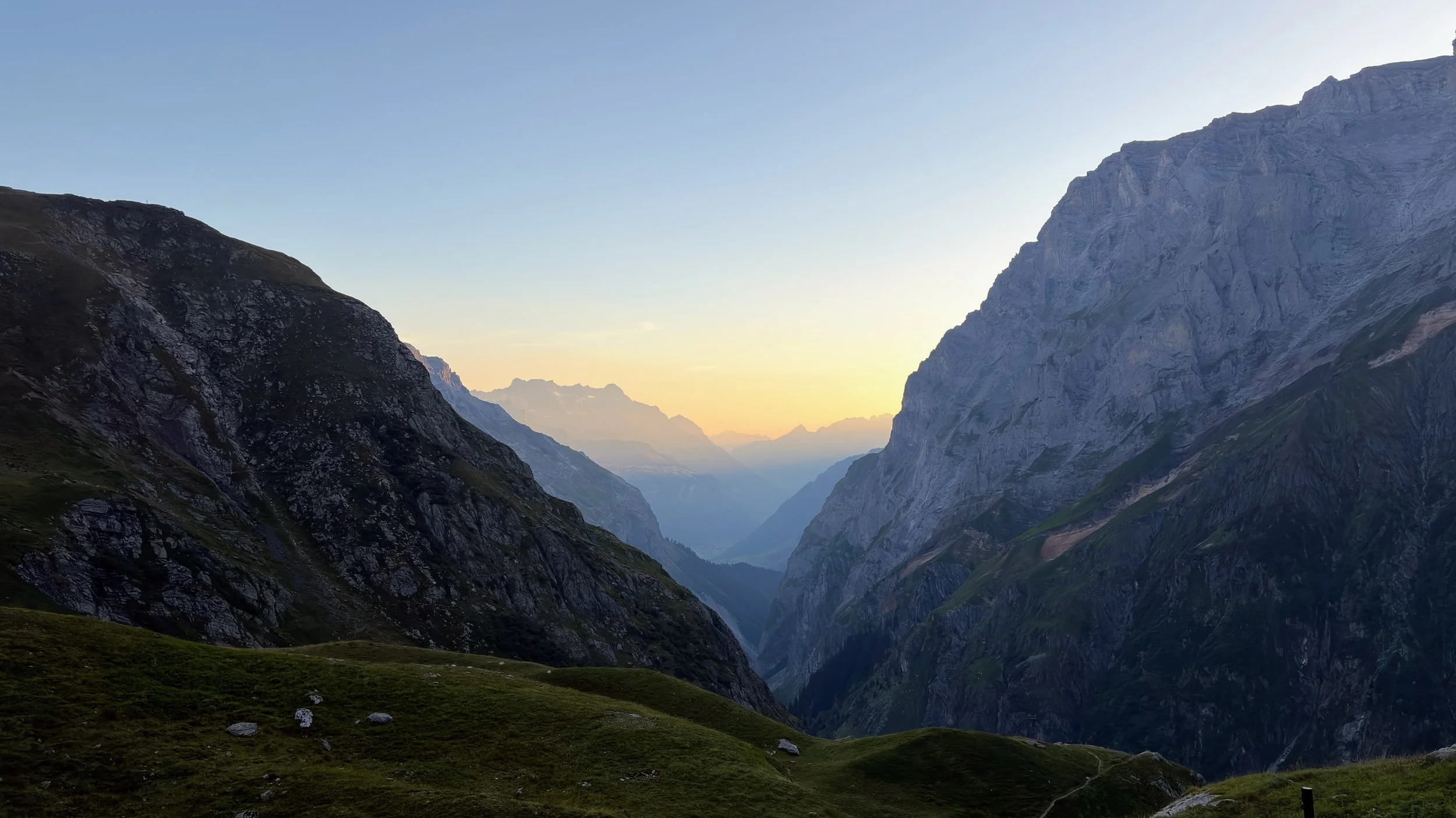
I finally pulled my head up and looked around, appreciating the epic scenery that surrounded the hut on all sides. Most notable was the northwest wall of the Hinter Schiben mountain ridge, with an odd orange stripe running along its entire length.
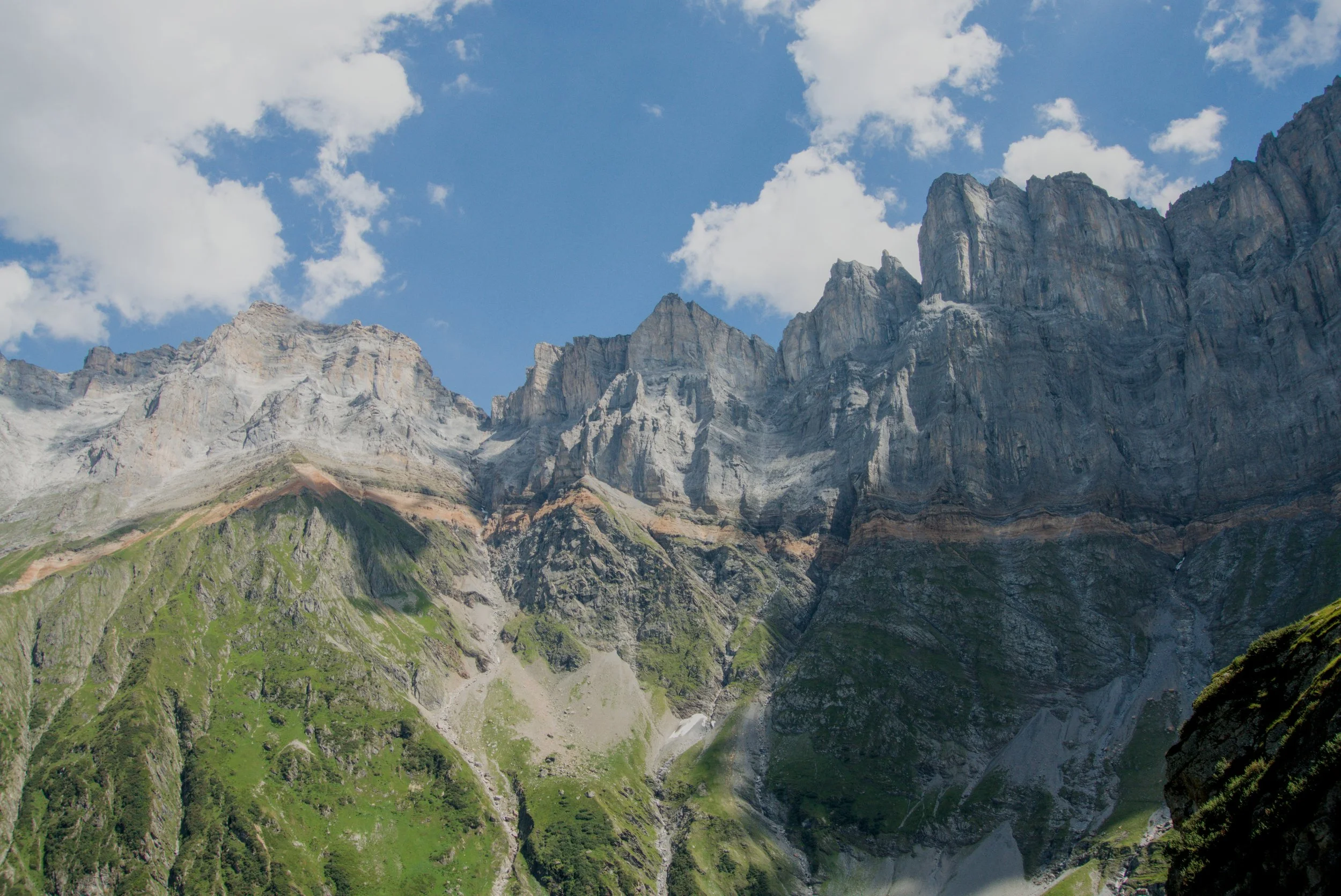
Some desktop research tells me the line is known as the Röti (red) Dolomite, formed in the late Triassic period 210 million years ago, and has a high iron content, which gives it a reddish color. The same band runs along the Todi massif to the south of the hut as well:
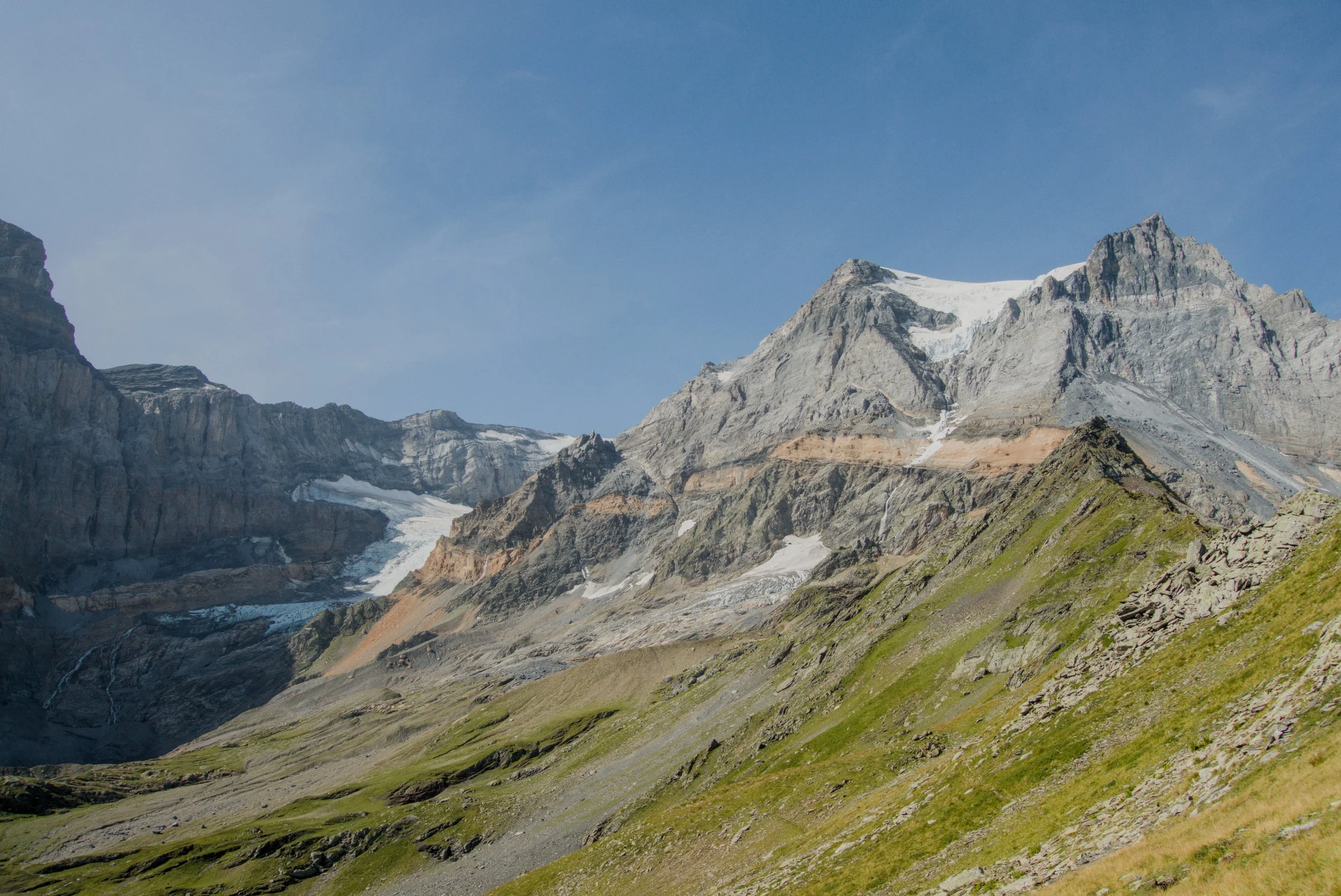
After some rest, I settled into the hut a bit and changed for dinner. Most of the other guests at the hut were there to climb Todi and had 3:00am alarms to get up to the summit before it got too warm the next day and the glacier began to move around in the midday heat.
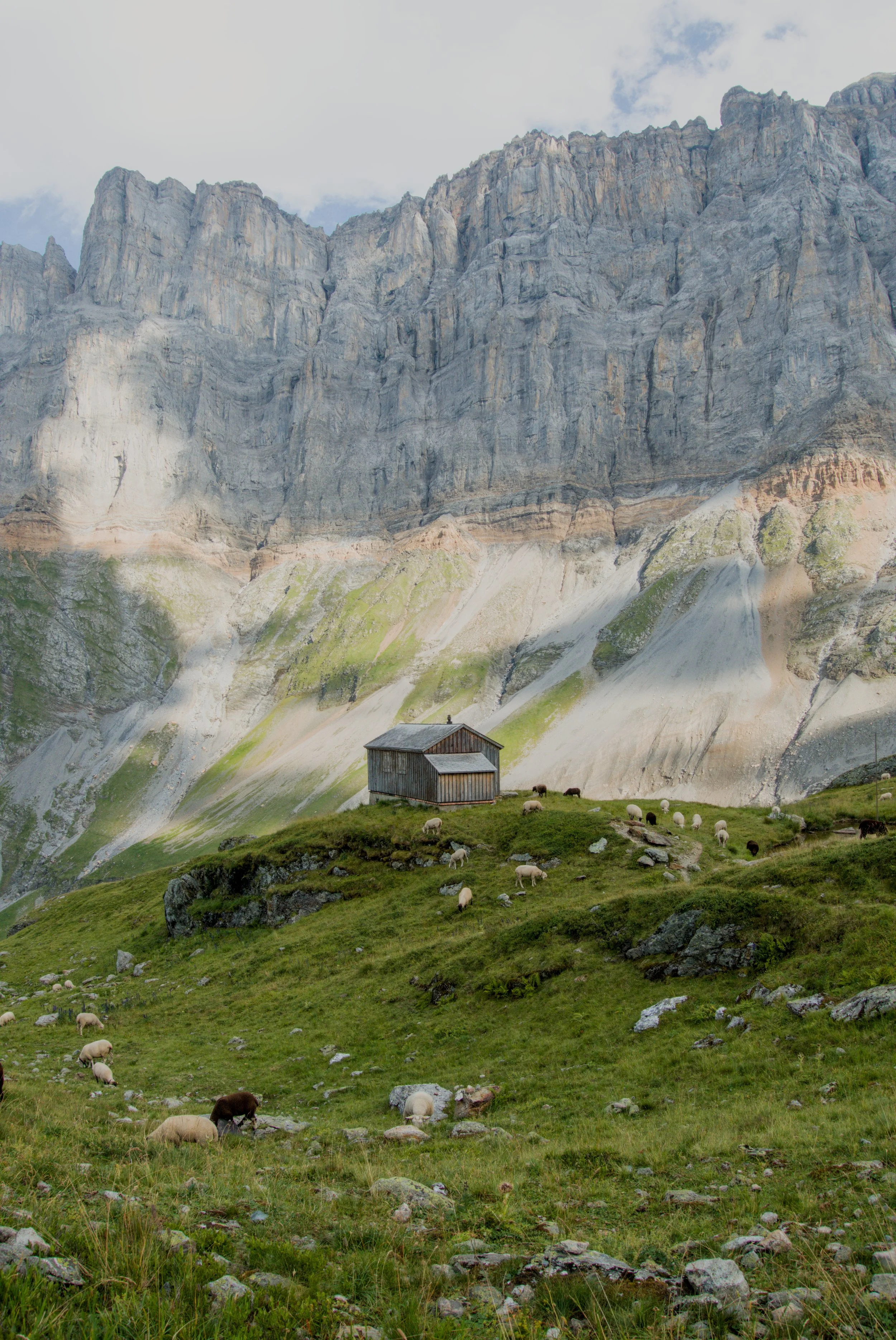
I had a swim in the small lake next to the hut and enjoyed a spaghetti dinner. There is a summer herd of sheep that wander around the hut and the hut team have built a fence to wall off these unabashed intruders from coming in and causing mayhem. Their bells create a constant, but stereotypical Swiss, cacophony of ringing all evening before they settle down for the night.
Day 2
Breakfast was some muesli, bread, jam, and alpine butter. As most guests left before sunrise, the dining room was much quieter for us normal folk eating at 7:00 am.
I packed up my things, settled the bill, and headed south toward the Todi glacier field to go see the oldest SAC hut, the Gruehorenhutte.
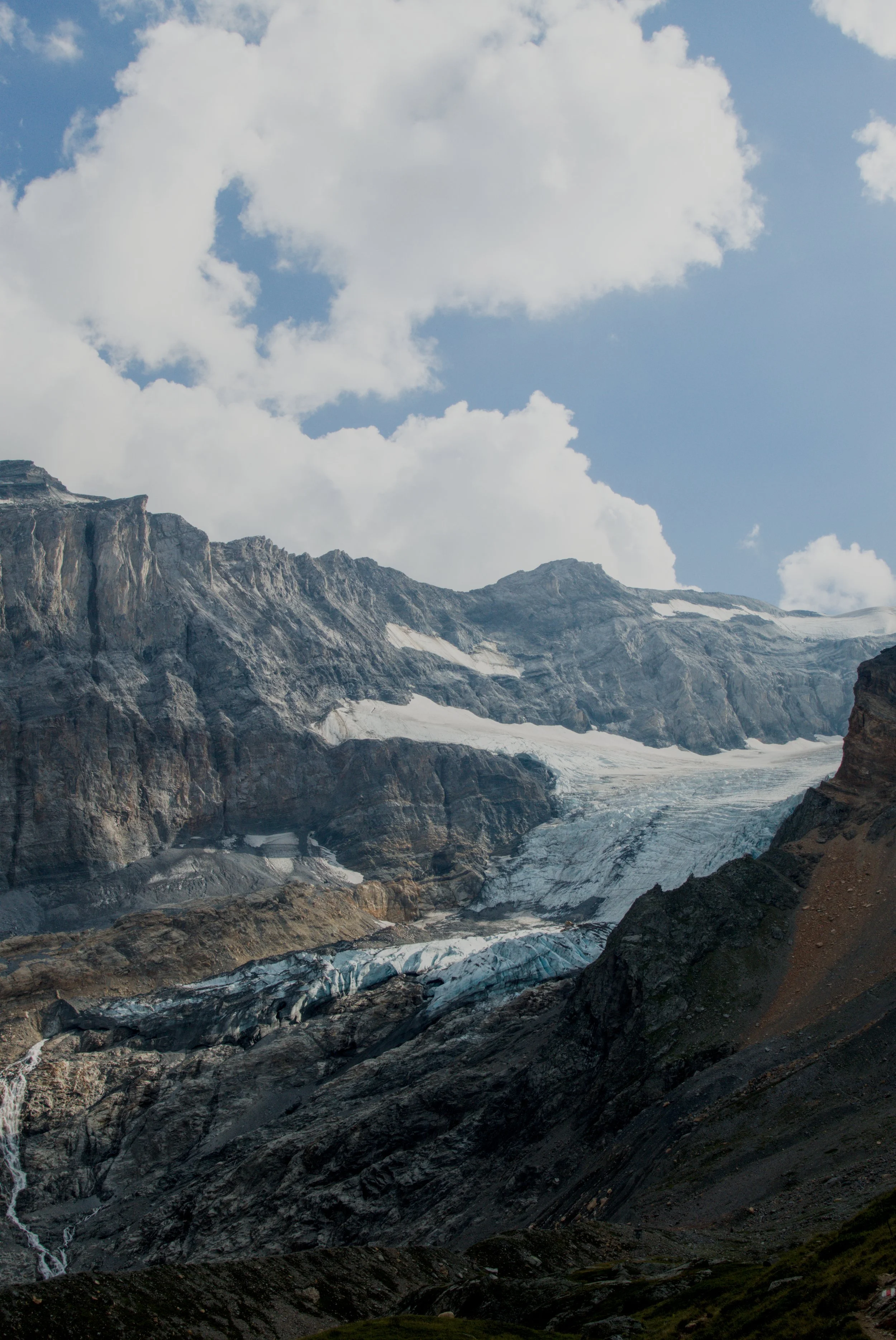
The Gruehorenhutte was built 190 years ago as the first official SAC hut and served as a refuge for people wanting to summit Todi. It is really no more than a rock shack, rather than a proper hut, but was one of the first buildings in the Alps to provide a roof and protection from the elements. So, the Todi became known as a “first class” destination since it had such comfortable accommodation at its base - how times have changed!
I dropped my backpack behind a boulder so I could run up to the hut and save some time for the long day ahead. The trail abruptly changes from grassy meadows to pure glacial rock fields at 2,150m asl.
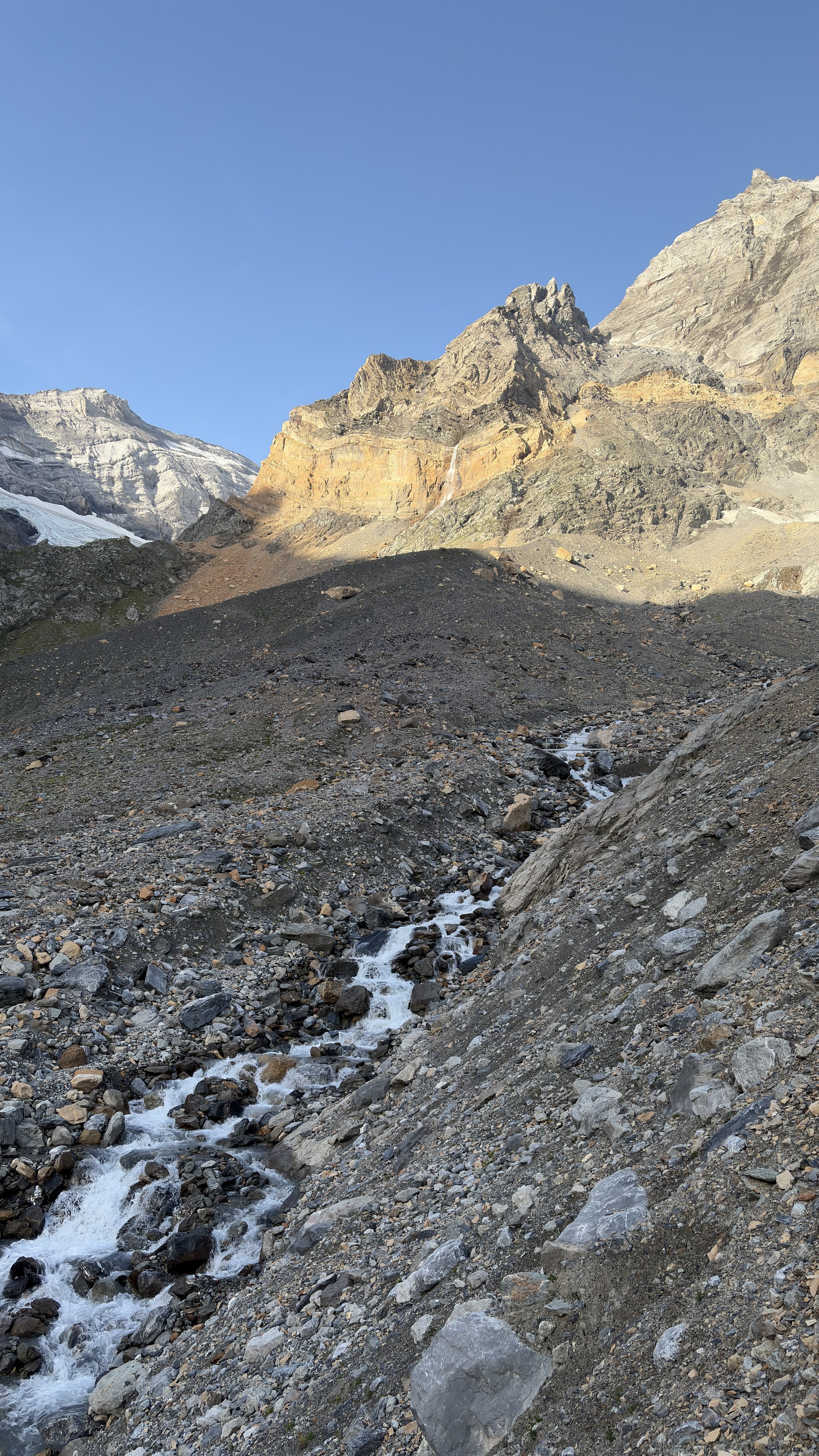
The outwash plain of the Biferten glacier sits below to the east and is a sad reminder of how quickly the glaciers are receding. The last 100m up to the hut are covered with chains to assist with the steep sections. The little building is perched on a thin ridge line that couldn’t fit anything larger than the current structure.
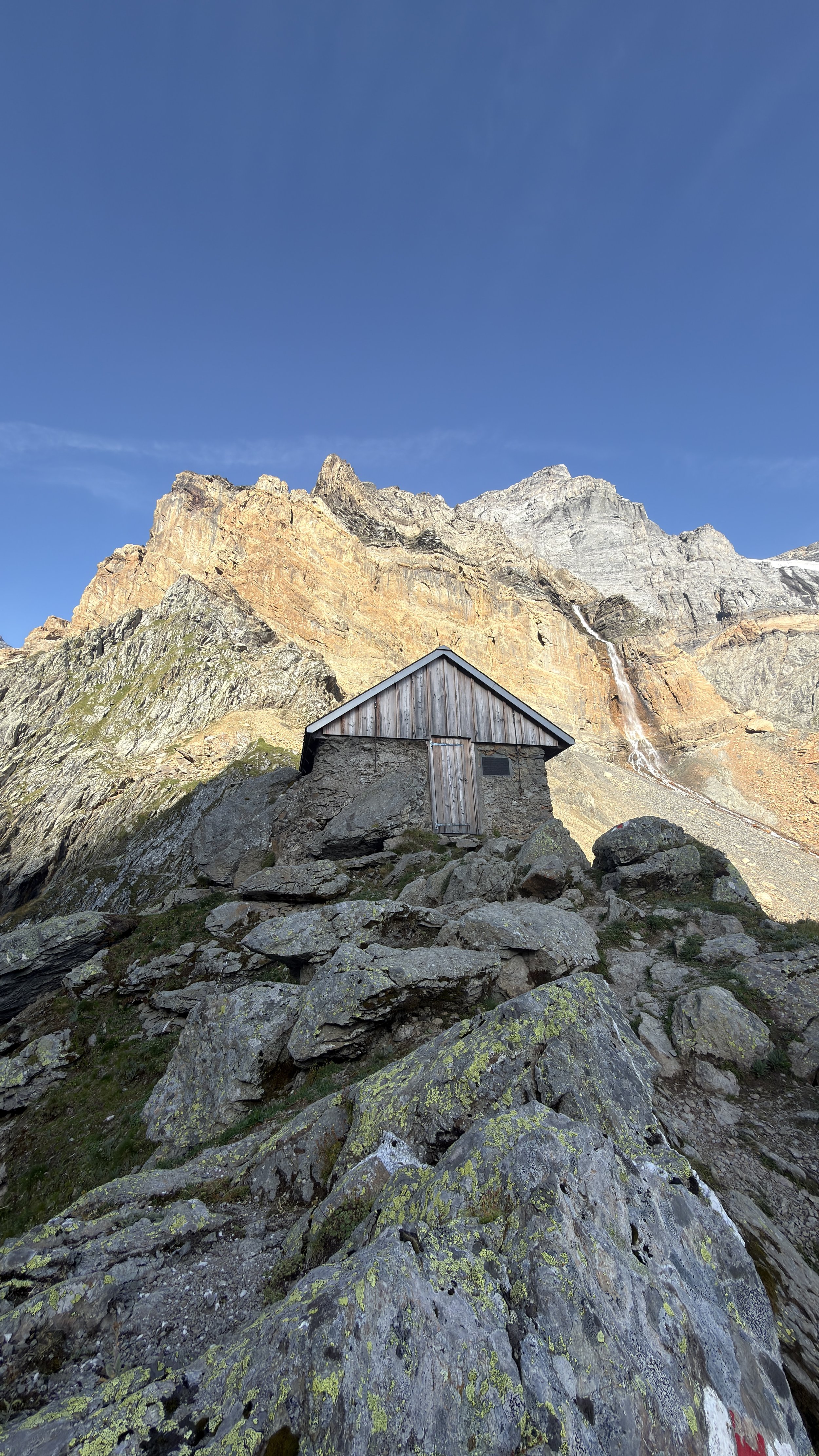
I read some of the information plaques in the hut which explained the history of the hut and the first ascents of Todi. The view from the hut is pretty epic with the glacier cascading down to the south and the Linthal valley to the north.
I headed back down to Fridolinshütte to grab my bag and head out for the day.
I first had to get over the Ochsenstock ridge which was an easy, relaxed ascent with a nicely graded trail. I took a brief break at the top of the ridge to test out my drone flying skills and attempt to take a video showing the sheer scale of this place:
The trail continued around the northern face of the Todi massif and mostly followed the 2,100 topo line which made for fast and pleasant walking. There is a very pretty snowmelt stream at point 2237 just below the Ochsenstock ridge that would be a nice spot to wild camp in the shoulder seasons.
The terrain alternates between tallus / boulder fields and grassy meadows for most of the trail as you descend down into Rossmattli. When you reach the valley floor and look west, the next objective really hits you… looking up the trail towards Piz Cazarauls you quickly appreciate how much climbing you have ahead of you to get to Planurahutte. This picture doesn’t do a good job of capturing the perspective, but it looks like an endless climb, and I can tell you from the future that it really is endless!
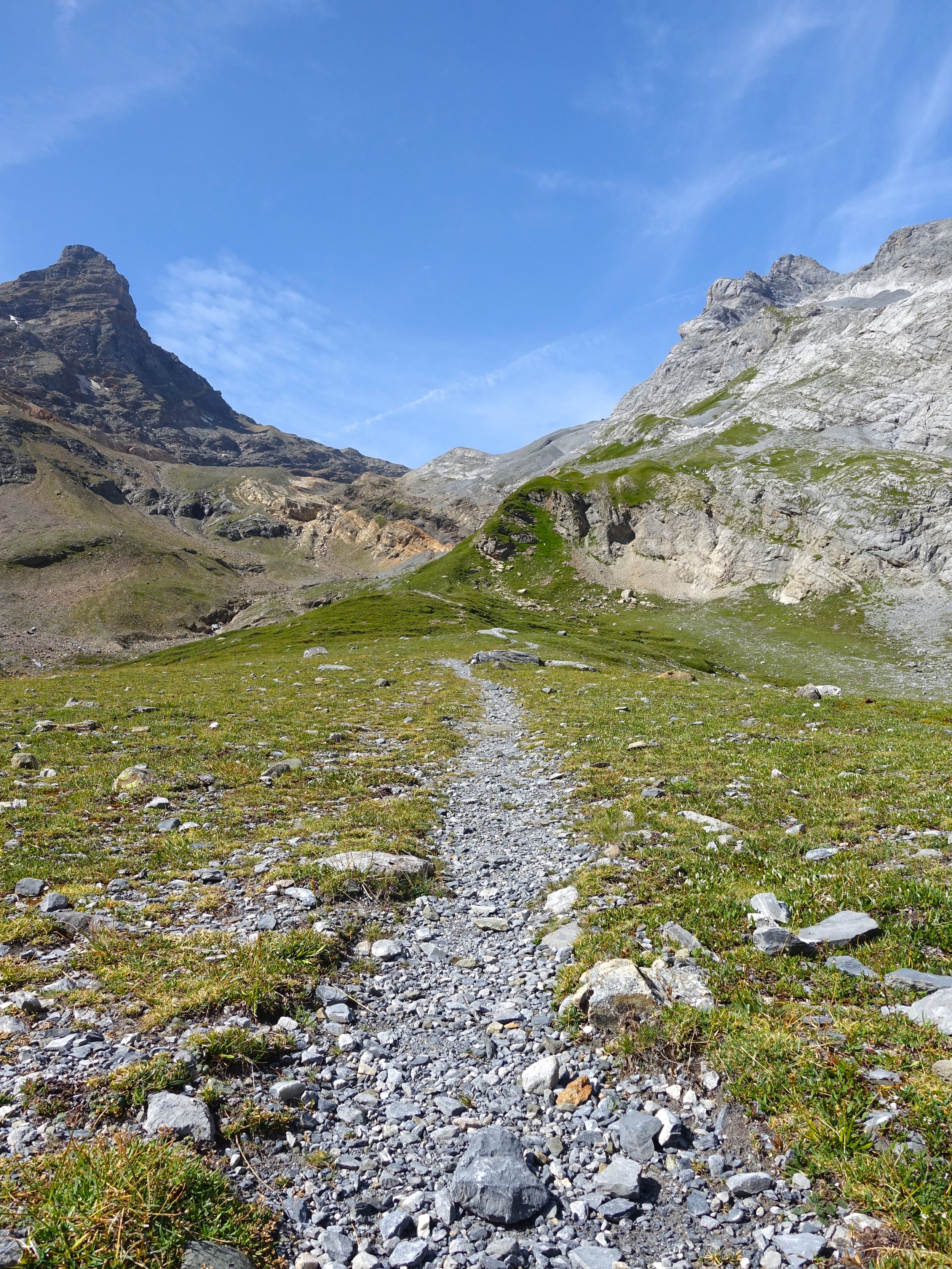
The idyllic alpine grassland gives way to a harsh grey landscape of scree that would be best described as lunar in its overall feeling. It is desolate and lifeless except for a few tiny flowering plants and moss that somehow survive in this hellish place.
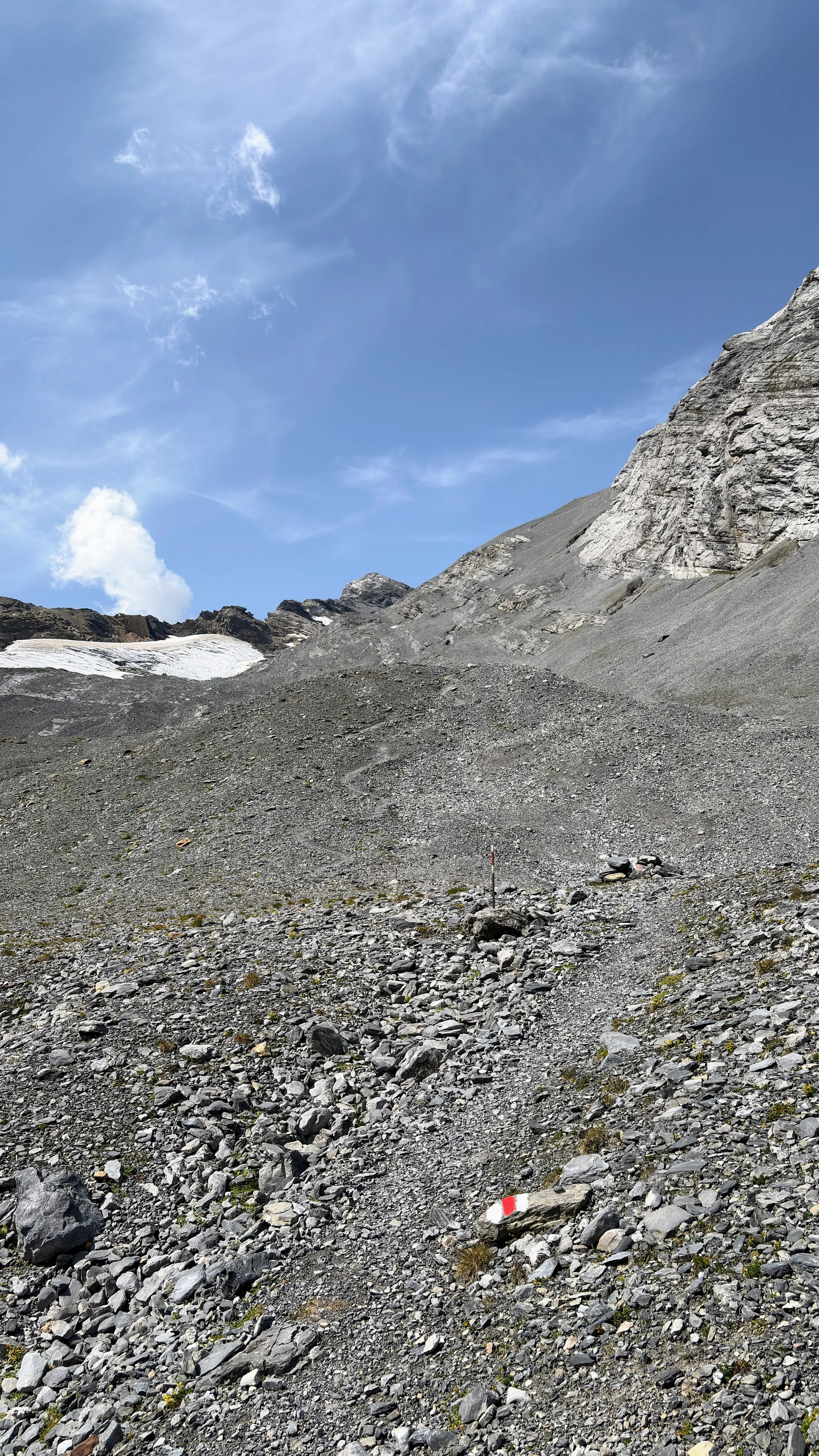
The gravel path is dotted with the red and white trail markings every few meters which, in many areas, is the only way to tell where to go as the constantly shifting rock from previous hikers covers up any semblance of a trail there may have been. As the route steepens, the gravel takes on sand-like qualities and for anyone that has tried climbing sand dunes knows, each step feels like a futile effort as you slide back down to where your foot started just moments before.
Around 2,500m asl, the gravel starts to give way to more solid rock and there are a handful of chained sections. I put the trekking poles away and had to climb up these few sections on all fours. In a few spots, I felt as though I should have had a harness and been clipped into something but that wasn’t an option.
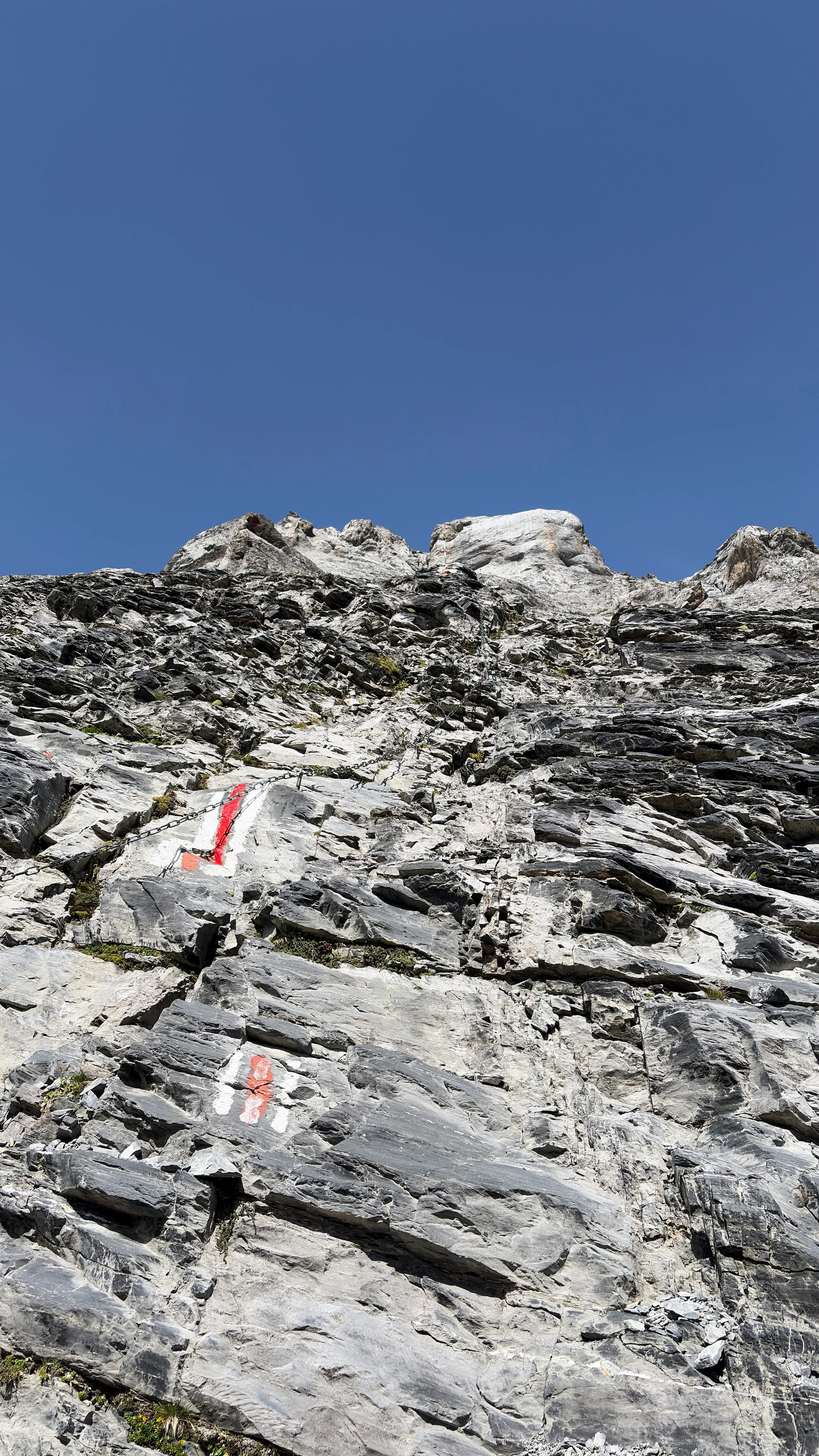
The red and white trail markings became even more frequent as the trail all but disspeared and the hiking turned into scrambling up, down, and around rock ridges. The rock was smooth, almost polished in some spots, from millions of years of glacial coverage.
Finally, after hours of climbing, the Planurahutte poked out of the ridgeline above.
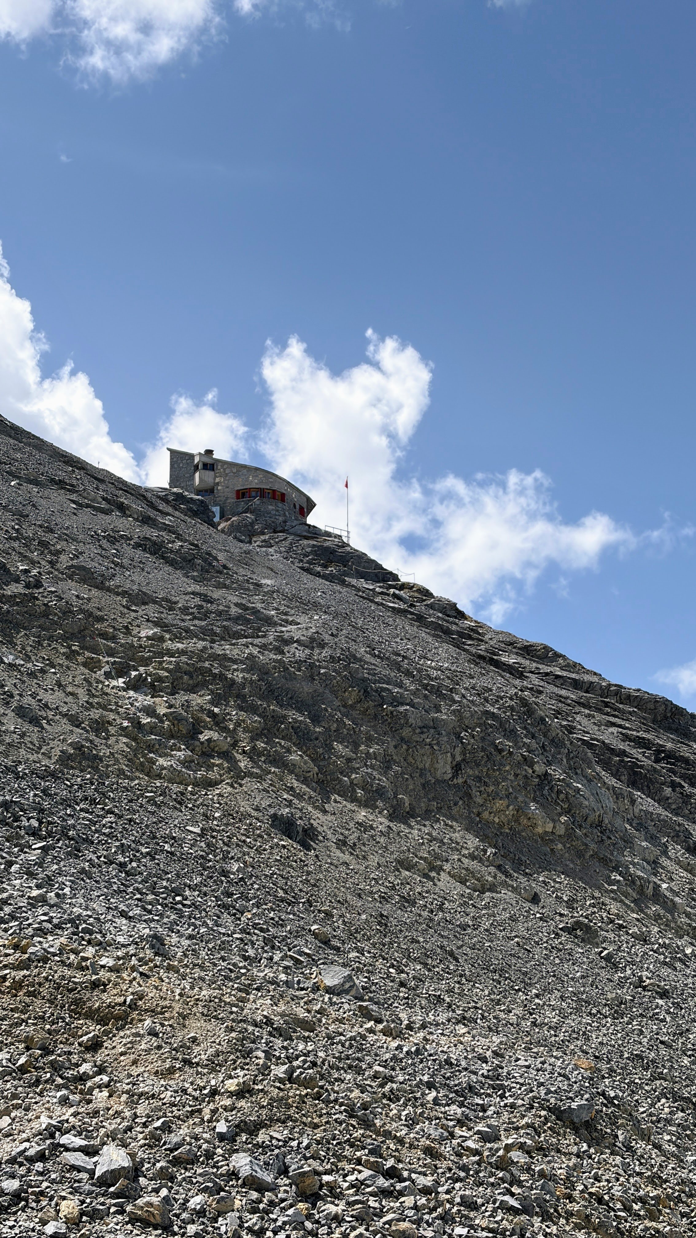
I stumbled into the hut which was empty on the Sunday afternoon with all the previous night’s guests already well on their way back down to the valley. I grabbed a coconut cake as all my snacks were long gone and enjoyed it on the hut’s helipad.
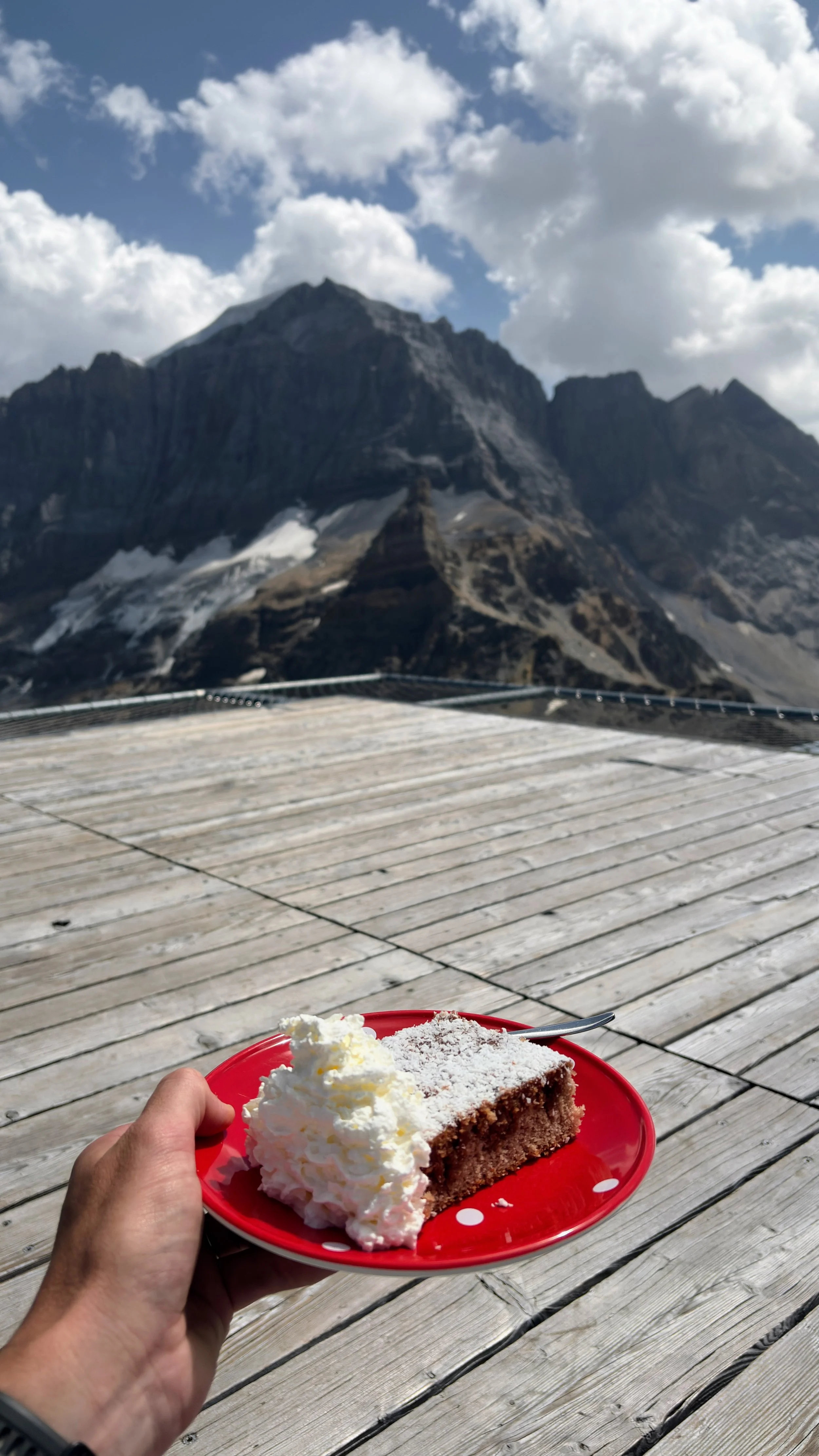
My body, and mind, for that matter, were completely beat after the 5-hour, 1,500m ascent. I retreated to my bed and passed out for a couple of hours while some afternoon showers rolled in.
I woke up as a few more guests arrived and popped out onto the hut’s terrace to finally appreciate the surroundings a bit more. Planurahutte sits like a bird’s nest on top of this little ridgeline nestled between Hinter Spitzalpelistock (what a name) and Piz Cazarauls. To the east, the Todi summit block occupies most of the frame. To the east, the jaw-dropping Hufi glacier field runs for kilometers down towards the Maderaner valley.
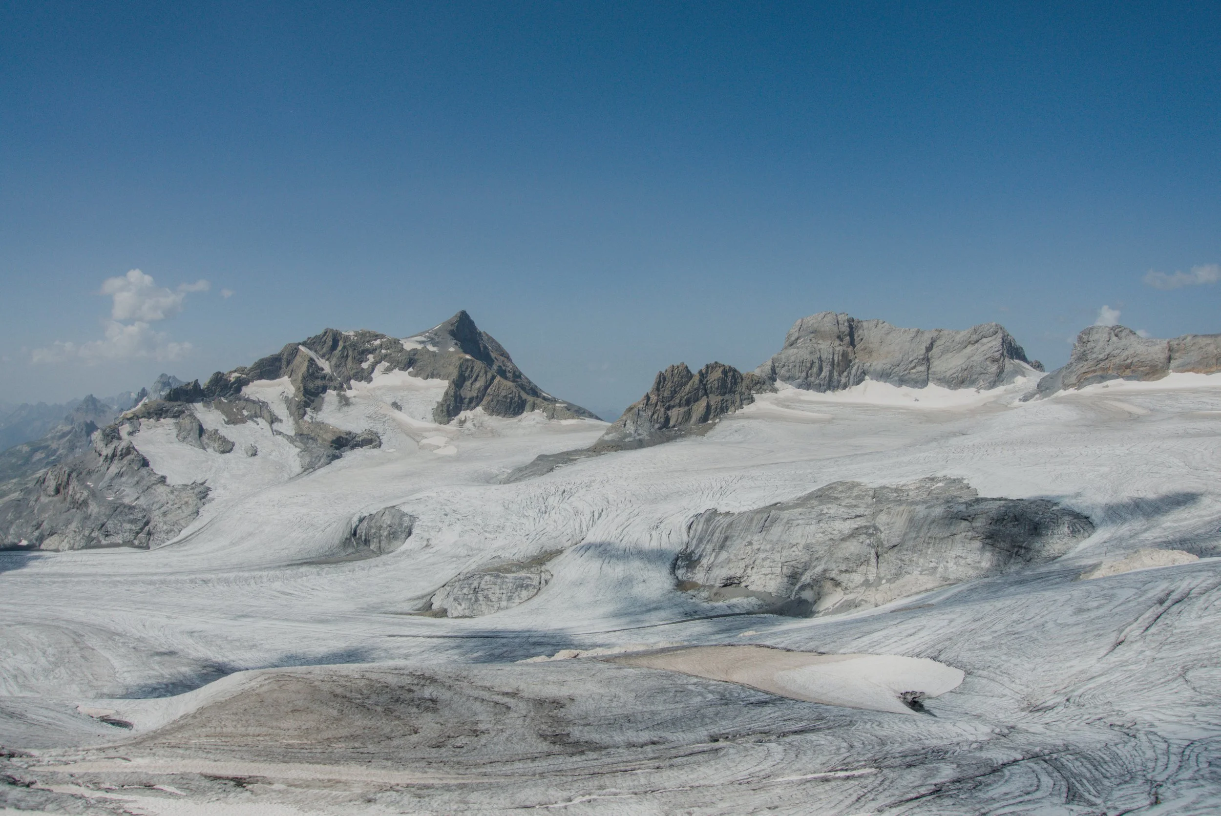
While its size is huge in absolute terms, the glacier is one of the fastest-decaying ones in the Alps due to its relatively low elevation and exposure to heat and lower snowfall amounts. It has lost 1,600m of its surface length in the last 150 years.
The other few guests and I enjoyed a delicious beef stew dinner and everyone headed out onto the terrace to enjoy the sunset over the glacier.
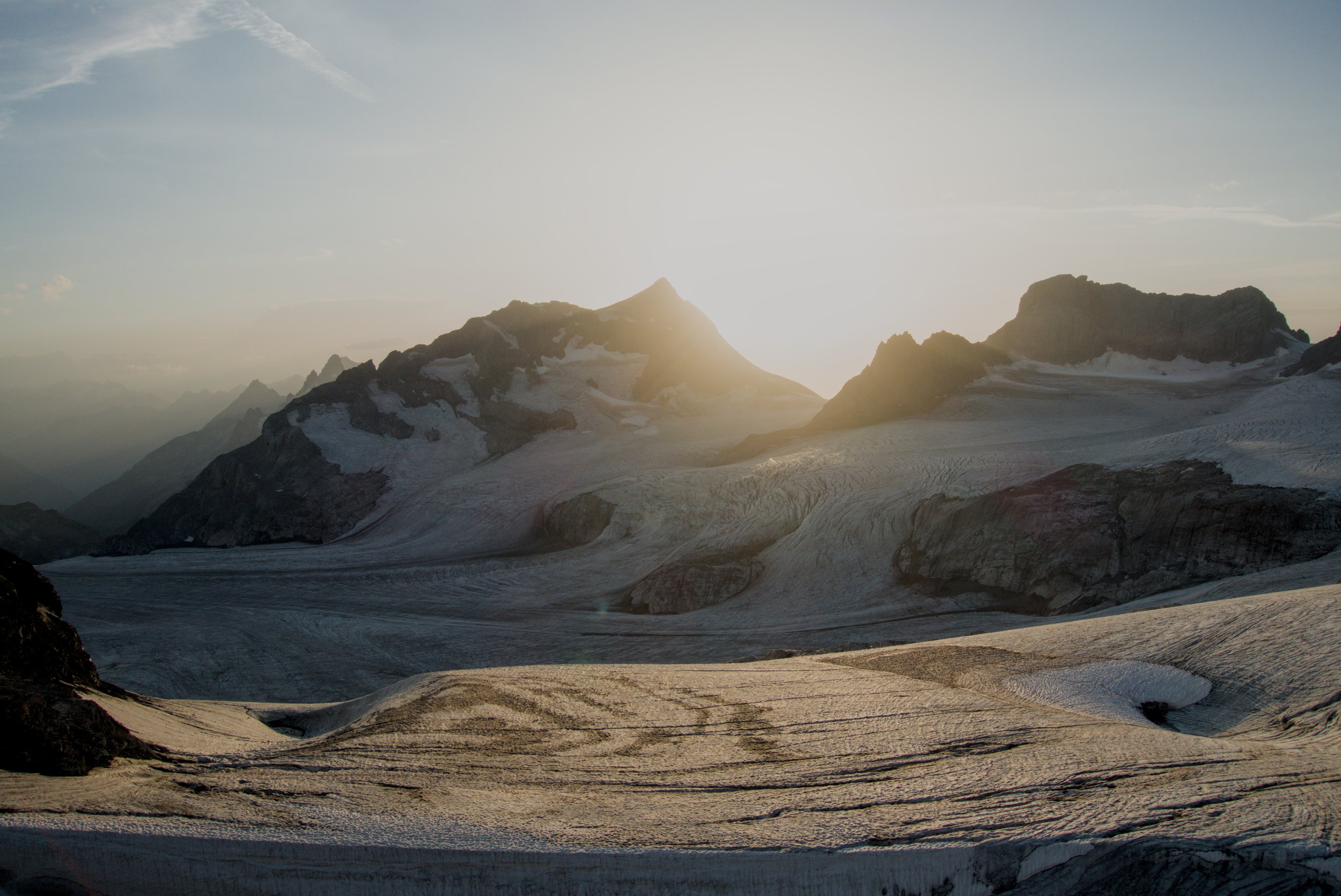
I got permission from the hut warden to fly the drone over the glacier and capture a view of the hut in the golden light. It was one of the most beautiful moments I’ve been lucky enough to enjoy in the mountains:
After a few card games, I retired for the night with a beaten body but a fulfilled spirit, having made it to my highest hut yet and in a place that my family had called home for centuries.
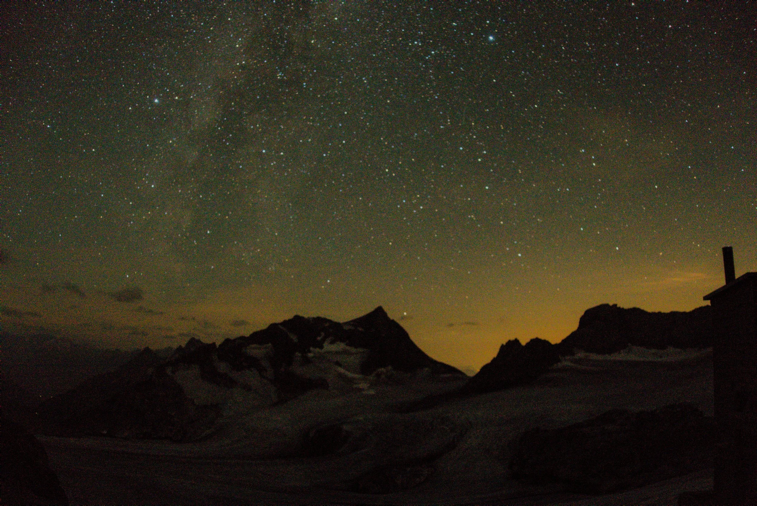
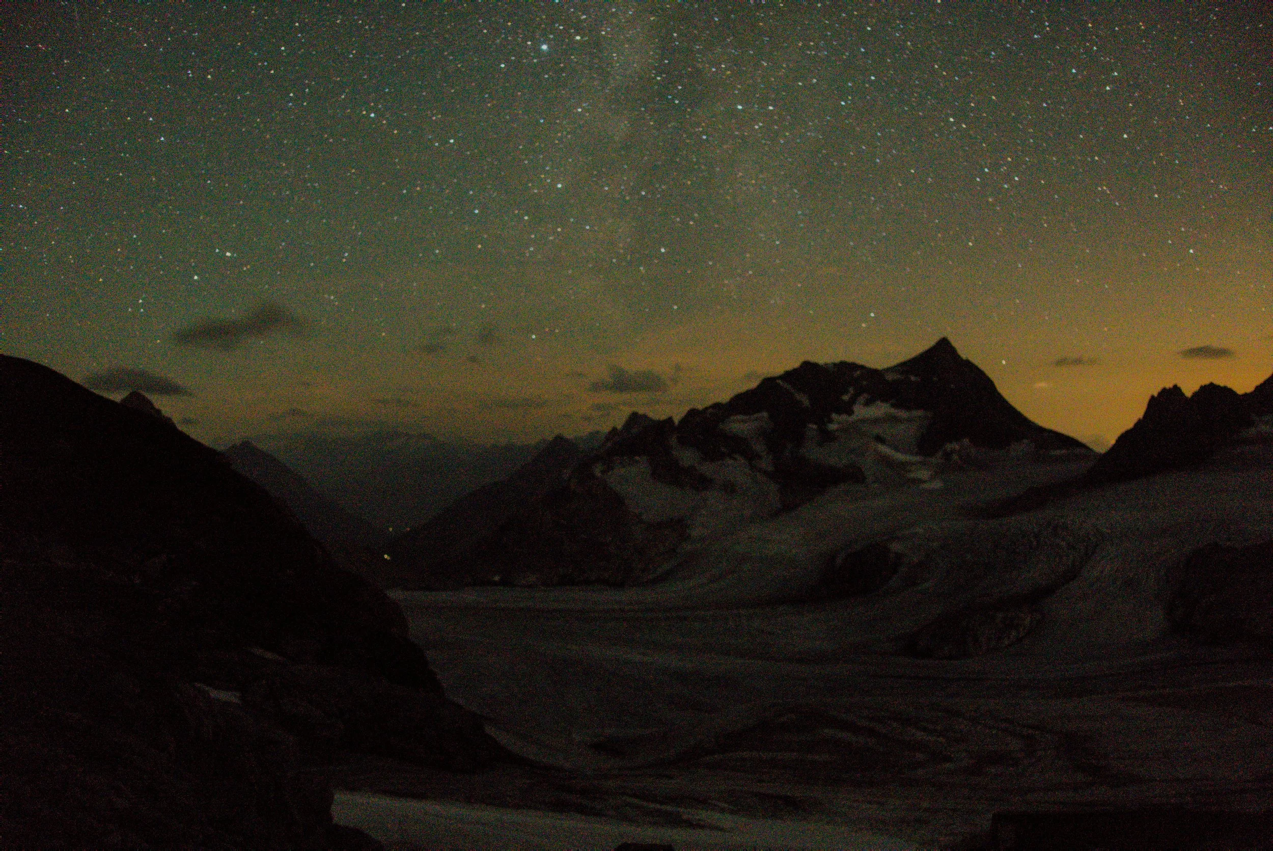
I woke up at 3:30am for a bathroom break and got a few photos of the starry night sky over the glacier, though my small but mighty Sony RX100 isn’t quite good enough to get crisp nighttime photos:
Day 3
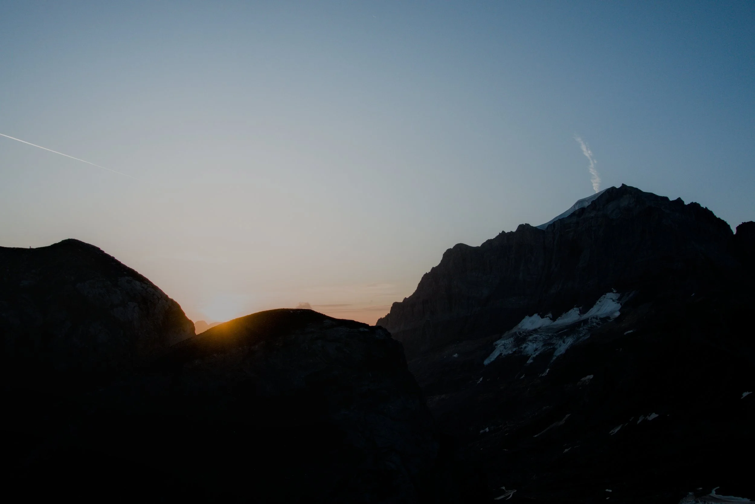
I woke up around sunrise and went outside to see the sun come over the Todi to the east.
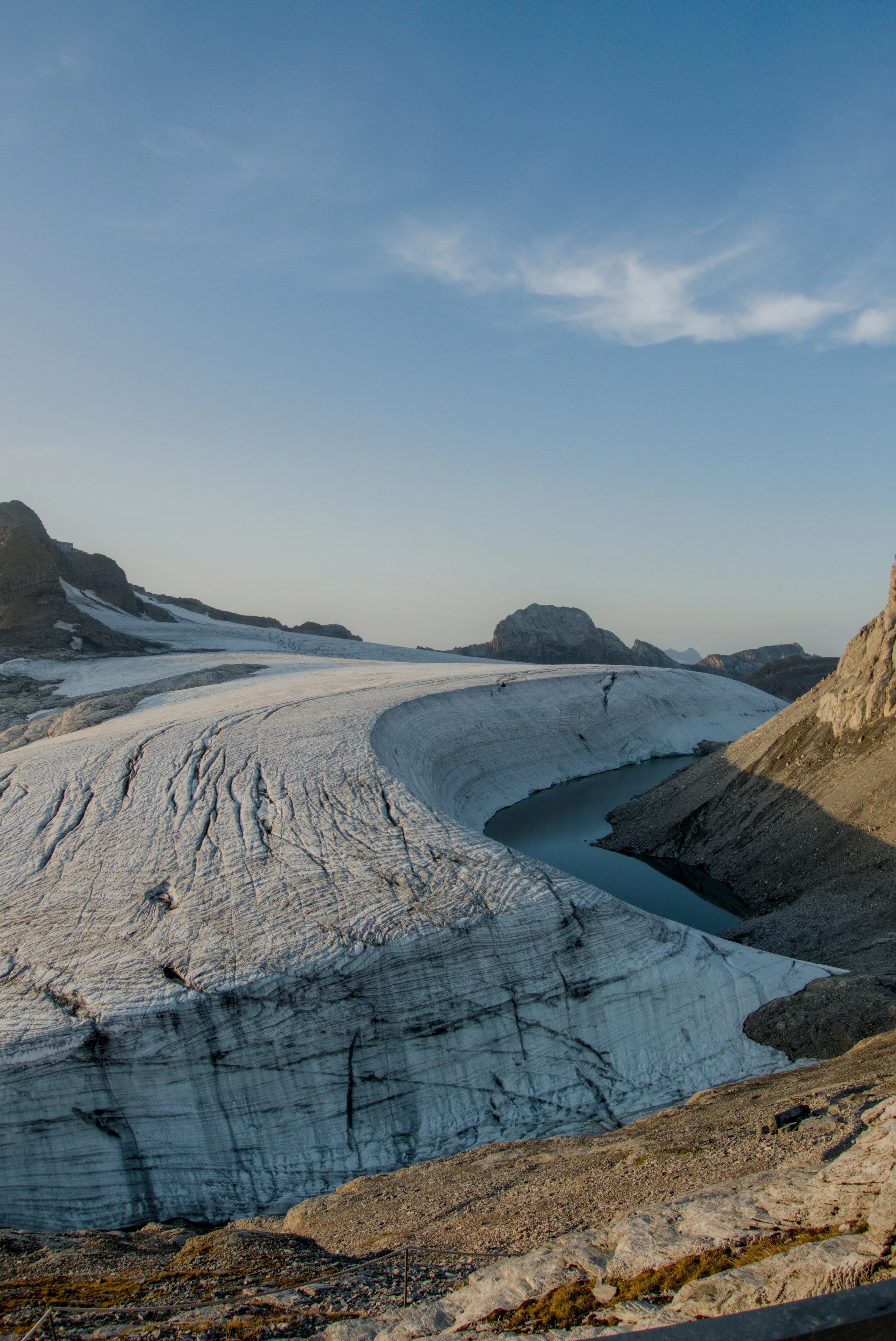
The most striking geological feature near the Planurahutte is the wind scoop glacier face below the Spitzalpelistock peak. It is 500m long wall that has been perfectly carved by the wind to create this sculpted facade of ice:
I scarfed down the breakfast of porridge and bread and then set off for the very, very long descent back down to Tierfed.
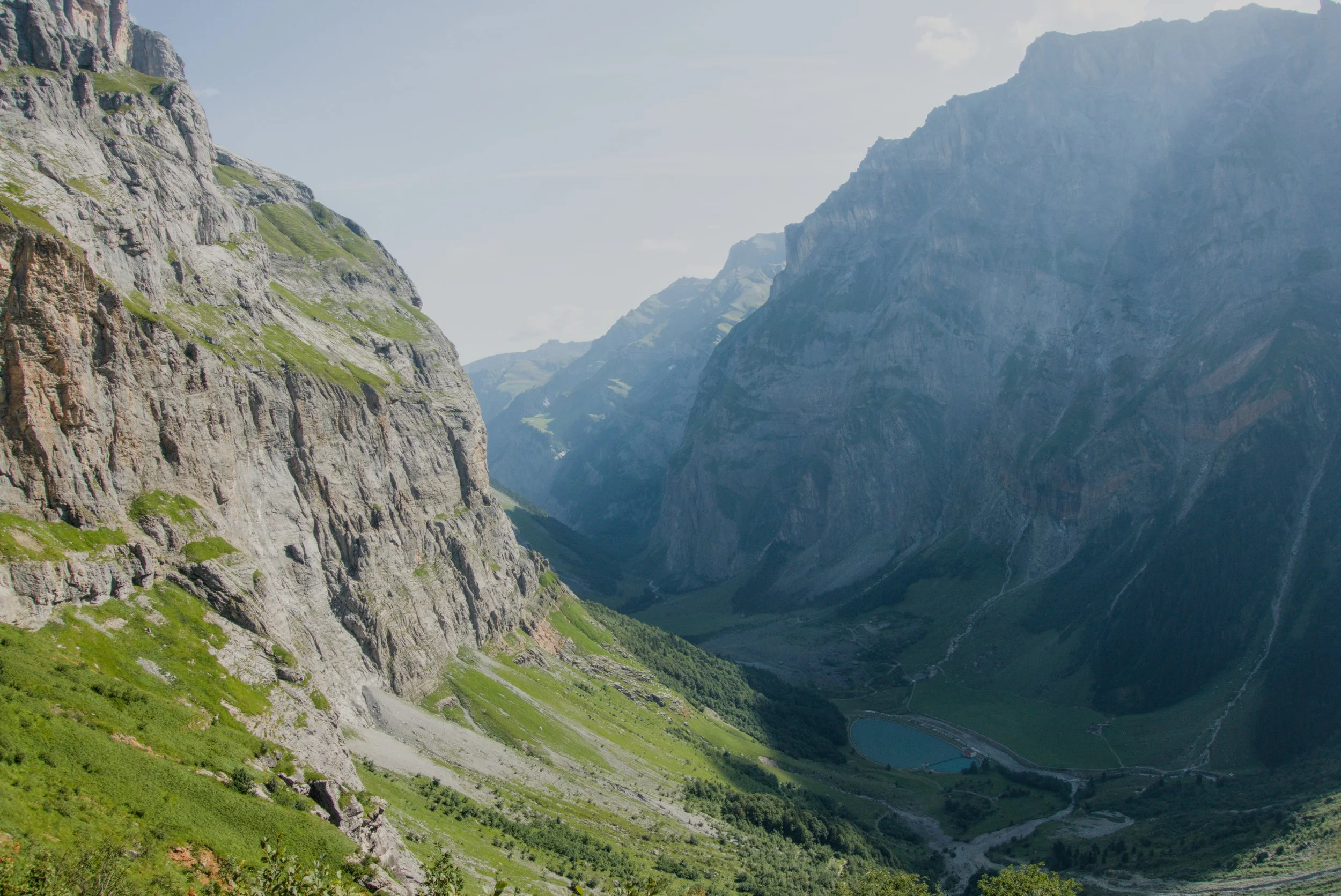
The high alpine rock and gravel sections were much more enjoyable with fresh legs and a downhill direction. The other hut guests joined me for the hike down and we made great time getting down to Chuestafeli. The view over the Hinter Sand valley from this spot was gorgeous and reminded me of Yosemite valley for some reason:
Dropping down into Hinter Sand was an absolute slog. According to the GPS file from my watch, there was a total of 63 switchbacks during the 700m descent from the upper valley. We all commented that towards the end we felt almost dizzy from the constant turning around - a merry go round from hell. In retrospect, I am glad I ascended through the other valley to Fridolinshutte the two days prior as this ascent path would have made me cry.
Once we were down in Hinter Sand, the shadow of Selbsanft provided cooler temps for the remainder of the easy walk down to Tierfed.
We got back to the car exactly 4 hours after we started that morning. With sore feet and happy smiles, we headed back to Zurich.
Thanks for the memories, Glarus. See you soon.